Originalbeiträge “Historic Maps and Imagery for Modern Scientific Applications”
|
|
| Rieke-Zapp, D., Rosenbauer, R., Ruthishauser, S. & Reiterer, A.: Editorial |
189 |
| Horst, T: Manuscript Maps as Sources for Cultural History and the History of Climatology |
191 |
| Jedrzejas, T. & Przybilla, H.-J.: Aufbau historischer 3D-Szenarien am Beispiel der mittelalterlichen Stadt Duisburg |
199 |
| Nebiker, S., Barmettler, A., Fischer, B. & Weber, E.: Vom physikalischen Stadtmodell zum historischen 3D-GIS – Anforderungen und Lösungsansätze am Beispiel des historischen Solothurns |
209 |
| Henze, F., Lehmann, H. & Bruschke, B.: Nutzung historischer Pläne und Bilder für die Stadtforschungen in Baalbek/Libanon |
221 |
| Stichelbaut, B. & Bourgeois, J.: The Aerial Imagery of World War One: A Unique Source for Conflict and Landscape Archaeology |
235 |
| Heck, V. & Vogel, S.: Rectification of Historic Royal Air Force Aerial Photos and Generation of an Aerial Image Mosaic of the Sarno River Basin, Italy |
245 |
| Galiatsatos, N.: The Shift from Film to Digital Product: Focus on CORONA Imagery |
251 |
|
|
Originalbeiträge
|
|
| Hebel, M. & Stilla, U.: Automatische Koregistrierung von ALS-Daten aus mehreren Schrägansichten städtischer Quartiere |
261 |
| Straub, C., Dees, M., Weinacker, H. & Koch, B.: Using Airborne Laser Scanner Data and CIR Orthophotos to Estimate the Stem Volume of Forest Stands |
277 |
|
|
Berichte und Mitteilungen
|
|
Berichte von Veranstaltungen
|
|
| 8. Oldenburger 3D-Tage vom 28.– 29. Januar 2009 |
289 |
Veranstaltungskalender
|
292 |
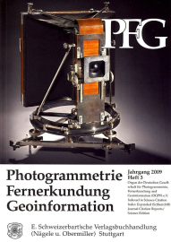
Zum Titelbild
|
293 |
Korporative Mitglieder
|
294 |